Emmanuel Logo

Emmanuel Abebresse

Geomatic Engineer / GIS Analyst

Portfolio

Mapping the World, One Project at a Time

Explore a collection of geospatial analysis, cartographic design, and surveying projects that showcase innovative solutions to complex spatial challenges.

20 Projects Completed
12+ Cities Mapped
100K+ Data Points Analyzed
Urban Heat Island Analysis
01
GIS Analysis Remote Sensing

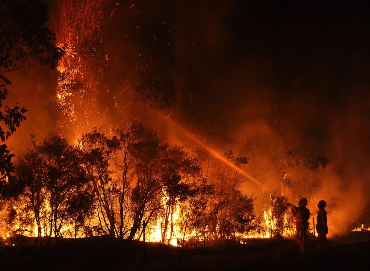
Shasta County(CA) Wildfire Analysis

The Shasta County wildfire project, analysed the spatial distribution and impacts of major fires across Shasta County using GIS-based risk modelling and impact assessment. Wildfire perimeters, incident points, data were overlaid with population density, infrastructure, land cover, and critical facilities to evaluate exposure and vulnerability.

ArcGIS Pro
3 weeks
Explore Project
Infrastructure Survey Project
02
Cartography GIS Analysis

West Wittering (UK) Historical LandUse

The West Wittering Historical Land Use GIS Project involved digitising and reconstructing a 1846 land use tithe map of West Wittering to create an accurate geospatial dataset for analysis and comparison.

ArcGIS pro · ArcGIS Online, SQL
2 weeks
Explore Project
Forest Change Detection
03
Remote Sensing Cartography

Iraqi Marshes Monitoring System

Multi-temporal analysis of Iraqi Marshes cover changes using Landsat and Sentinel-2 imagery. Developed automated NDVI change detection algorithms to track patterns over a 10-year period.

Remote Sensing, NDVI, ArcGIS pro
1 month
Explore Project
Interactive WebMap — Ghana Lands Commission Parcel Plans
04
Web Mapping GIS Analysis

Ghana Lands Commission — Digital Plan Proposal

A proposal to modernise Ghana Lands Commission approved parcel plans by integrating an interactive WebMap and Google Maps link embedded in a QR code, enabling clients to visually explore their land parcel via satellite imagery.

QGIS, WebMap, QR Code, Google Maps API
2 months
Explore Project
Flood Risk Assessment
05
GIS Analysis Cartography

River Medway Flood Risk Analysis

This project applied GIS-based multi-criteria analysis (MCA) to identify and map suitable locations for Nature-Based Solutions (NbS), such as; Flood Reconnection, Run-off Attenuation Features, Large Wood Debris, Wet Woodland, across the Medway catchment, Kent to mitigate flood risk witihn a government budget of 1.5million pounds.

ArcGIS, Remote Sensing, Hydrography
8 weeks
Explore Project
Historical Map Recreation
06
Remote Sensing Land Survey

Broadway Terrain Analysis

Detailed Terrain Evaluation project documenting geomorphological heritage and urban evolution. To assess the possibility of a Gas Pipeline route within the broadway study location.

QGIS, Field Survey ArcGIS pro, Land Survey
6 weeks
Explore Project
Completed residential development Accra Ghana
07
Land Survey GIS Analysis

Construction Survey — Residential Development, Accra

Licensed surveyor role supporting a full residential construction programme in Accra — directing technicians through site reconnaissance, differential levelling, foundation setting-out, and milestone construction checks across two residential units from clearance to completion.

Automatic Level, Levelling Staff, Total Station, AutoCAD
6 months
Explore Project

Have a Geospatial Project in Mind?

Let's collaborate to turn spatial data into actionable insights

Get in Touch